


Citymapper
4.84.97K Reviews
App Specs
- Version
- Varies with Device
- Updated On
- License
- Free
- Downloads
- 10,000,000+
- Developer
- Citymapper Limited
- Categories
- Maps & Navigation
- Platform
- Android, iOS
Screenshots
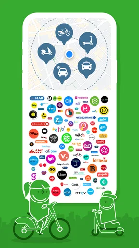
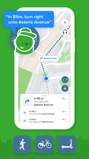


 Analysis by AppCompare
When I’m in an unfamiliar part of a city, the hardest part is often not finding a route but choosing one I can follow confidently. A map can show where the trains go, yet leave me guessing about transfers, walking time, or whether a bus is a sensible alternative. Citymapper is built for that everyday decision-making: it brings city travel options together and helps turn a destination into a practical journey.
Who benefits most from its city-first approach
I find it most useful when a trip involves public transport, a change of plan, or a neighbourhood I don’t know well. Rather than treating the subway map as the whole answer, it lets me consider transit alongside walking and other ways of getting around. That makes it particularly handy for visitors who need more guidance than a street map provides, and for residents who want to compare familiar routes when service conditions change.
It is a free maps and navigation app from Citymapper Limited. Its public profile is strong, with an average rating of 4.8 from around 361,000 ratings and more than 10 million installs. The app is rated for Everyone. That broad audience makes sense for a practical travel tool, though the best experience still depends on whether its coverage and route information suit the city you are travelling in.
Readability and navigation under pressure
Ever found yourself staring at a subway map with absolutely no idea where to start? Yeah, me too. But then I stumbled across Citymapper, and let me tell you, this app has been a total game-changer for my urban adventures. It's like having a local guide in your pocket, minus the awkward small talk.
Getting Around with Ease
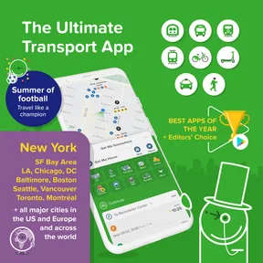
First off, the interface is slick. I mean, it's not just functional—it's actually fun to use. You open up Citymapper, and you're greeted with a neat little map that's begging to show you around. The app covers a ton of cities, so whether you're in New York, London, or even Tokyo, it's got your back.
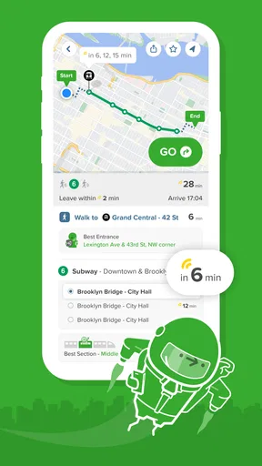
What I love most is how it gives you multiple transit options. You can choose from subway, bus, bike, or even walking routes. It even factors in real-time data, so you're updated with any delays or changes. No more guesswork or missed connections, which is honestly a lifesaver when you're running late (been there, done that).
Features That Stand Out
Alright, let’s talk features because this app is packed with them. One of my favorites has to be the "Get Me Home" button. Tap it, and boom, you've got a route home quicker than you can say "lost tourist." And for the indecisive or adventurous types, there's the "Explore" option. This lets you check out different parts of the city without having a set destination in mind. It's like wanderlust on steroids.
Worth Reading Before You Choose

Baby Panda World Brings Quick Play to Modern Phones, but Its Game Library Feels Busy

ESPN’s Live Game View Makes Following Close Games Easier

QuizzLand Review: A Good Fit for Short Trivia Breaks, Not Every Player

Basketball Stars: Multiplayer Is Fast, but Can It Recover When Matches Go Wrong?

WEBTOON Turns Phone Updates Into a Better Reading Routine

Link to Windows Runs on Shared Habits, Not Social Feeds
Another nifty feature is the "Smart Commute." You tell Citymapper your regular routes, and it gives you live updates based on current conditions every morning. It's like your personal travel assistant, minus the coffee runs.
Planning a journey around your needs
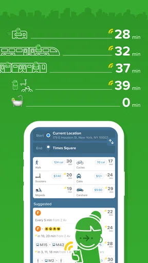
Planning a journey has never been easier. You can enter your starting point and destination, and Citymapper will lay out all your options. It even gives you the cost and calorie count for each route. Yes, you read that right—calories! It's perfect if you're trying to sneak in some exercise without hitting the gym.
For the eco-conscious, it highlights routes with lower carbon footprints. And if you're feeling extra green, why not try the bike-share or walk options? It's amazing how the app caters to different preferences and needs.
Motor and sensory considerations
When I’m travelling with someone who needs fewer stairs, a slower pace, or more time to read directions, I don’t assume that the fastest result will be the most workable one. I compare the options and consider the whole trip: getting to the stop, making the transfer, and walking from the final stop. A route that saves a minute on paper may be a poor choice if it means hurrying through a crowded station.
Citymapper can make route choices easier to compare, but navigation still asks the traveller to interact with a screen and keep track of changes while moving through a busy environment. I’d check the route before entering a station, then pause somewhere safe to review it if plans shift. That small habit matters if reading while walking is uncomfortable, or if using a phone one-handed is difficult.
For sensory comfort, I’d also think about the journey itself rather than relying only on the app’s ordering of routes. A familiar bus may be preferable to a packed train; a longer walk may be calmer than a complicated transfer. The useful point is that having alternatives gives me something to weigh, not that one route is automatically comfortable or suitable for everyone.
Real-Time Updates
Now, let’s discuss real-time updates. We all know that public transport can be unpredictable, but Citymapper keeps you informed with live data. This means you can dodge those pesky delays and find alternative routes if needed. It's like having a sixth sense for travel mishaps.
The app also sends notifications if there are any major disruptions, so you're never caught off guard. It’s like having a friend keep you in the loop while you’re on the move.
A realistic trip, and a useful habit
Imagine leaving work for an appointment across town just as your usual line becomes disrupted. I’d use the journey planner to compare a bus-and-walk option with a route involving a transfer, then check the live information again before committing. If the disruption changes while I’m on the way, the alternative routes can help me decide whether to stay on course or switch. I would still leave enough time to make the connection: live guidance is useful, but it cannot make a crowded platform or a delayed vehicle predictable.
One practical habit is to plan from the actual place you can reach, not just the station name that looks closest on a map. A long station entrance or a difficult crossing can change how manageable the first leg feels. I also like checking the return journey before heading out, especially when I’ll be somewhere unfamiliar after dark or during a busy period. It gives me a clearer sense of my options without requiring me to memorise the whole network.
Little Extras
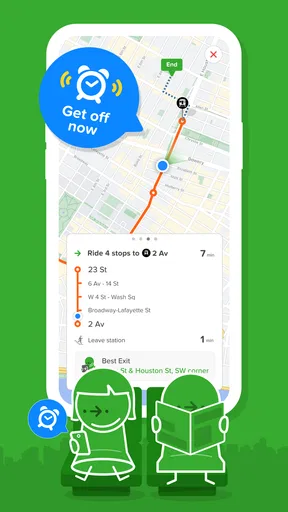
Beyond the basics, Citymapper throws in some delightful extras. For instance, it shows you which subway car to get on for the fastest exit—a small detail, but it makes a big difference during rush hour. The app also syncs with your calendar, so you can plan your routes around your appointments.
Another cool thing is the integration with ride-sharing services. If public transport isn't your thing, you can compare the cost and time for a cab or rideshare directly within the app.
How it compares with a standard map
A general-purpose map is often the better tool when I mainly need street names, a broad overview, or directions for a driving trip. Citymapper’s value is more focused: it helps me think through urban transit choices, transfers, and walking as parts of one trip. I would not treat it as a replacement for every navigation app. I’d use whichever tool best matches the journey, and I’d cross-check important details if a route depends on a tight connection or a station I have never used.
That focus is also a trade-off. The app makes most sense in cities where its transport information is useful; someone travelling mostly by car, or living somewhere with limited public transport, may get more from a conventional map. And although a ride option can help with comparison, I would check the actual service’s details before booking. Putting choices in one place is convenient, but the final decision still belongs to me.
Remaining barriers and sensible limits
No route planner can remove every barrier from a city journey. Stations, pavements, lifts, crowds, weather, and service changes all affect whether a suggested route works in practice. I would not assume that the quickest result is step-free or suitable for a particular mobility need without checking the relevant local information. If accessibility is essential to the trip, I’d verify the critical parts of the route with the transport operator or another reliable source before setting out.
There is also a simple attention cost: comparing several routes can be helpful at home, but distracting when I’m already walking through a crowded interchange. I prefer to make the main choice before travelling, keep an eye out for signs on the ground, and use the app as a guide rather than stare at it continuously. Notifications and live updates are useful prompts, not a promise that every change will reach me at the ideal moment.
The app is free to download, with optional in-app purchases listed from $1.49 to $99.99 per item. I’d start with the free experience and only consider a purchase if I understand what it adds and expect to use it. That keeps the decision practical, especially for someone who only needs help with occasional trips.
Who should choose it, and who might not
I’d recommend it to people who regularly navigate public transport in supported cities, visitors who want help comparing ways across town, and commuters who value checking alternatives when their normal trip changes. Its multiple modes can also help anyone trying to balance time, walking, and convenience instead of automatically choosing the first route they recognise.
I’d skip it as my primary tool if most journeys are rural, car-based, or outside the places where its city transport coverage is useful. I’d also avoid depending on any single app when a missed connection would have serious consequences: check the operator’s information, allow a buffer, and have a backup plan. Those are sensible travel habits, not a weakness unique to this app.
Inclusive verdict
So, is Citymapper worth downloading? In my humble opinion, it's a resounding yes. Whether you're a local or just passing through, this app takes the stress out of city travel. With its intuitive design, comprehensive features, and real-time updates, it's like having a travel buddy who knows the city inside out.
Its clearest strength is giving me different ways to approach a city trip, which can support different preferences and circumstances. That flexibility is not the same as guaranteeing that every route will work for every ability, so I still check the details that matter to my journey. For someone who depends on particular station facilities or needs a very predictable route, a second source and a little advance planning remain important.
The next time you're navigating the urban jungle, give Citymapper a spin. You might just find yourself wondering how you ever managed without it. Safe travels!
Pros
- Intuitive user interface enhances navigation.
- Real-time updates on public transport delays.
- Comprehensive multi-city coverage.
- Offline maps for data-free navigation.
- Includes bike and scooter rental options.
Cons
- Can drain battery with prolonged use.
- Occasional inaccuracies in travel time estimates.
- Limited features in smaller cities.
- Requires internet for live updates.
- Ads in free version can be intrusive.
FAQs for Citymapper
What features does Citymapper offer for navigation?
Citymapper provides comprehensive navigation options, including real-time public transit updates, walking directions, and cycling routes. It integrates multiple modes of transportation like buses, trains, subways, and even ride-sharing services. Additionally, users can access live departure times, disruptions, and step-by-step journey guidance to ensure a smooth travel experience.
Is Citymapper available in my city?
Citymapper is continually expanding its coverage and is available in many major cities worldwide. To check if the app is available in your city, you can visit their official website or download the app and search for your location. The app focuses on metropolitan areas with complex transit systems.
How accurate is Citymapper's real-time data?
Citymapper is known for its reliable real-time data, sourced from official transit agencies and other verified partners. While it strives for high accuracy, external factors such as network disruptions or unexpected delays can affect the data. Users can contribute by reporting issues directly through the app to help improve accuracy.
Does Citymapper require an internet connection to function?
Citymapper primarily relies on an internet connection to provide real-time updates and accurate navigation. While some basic functionalities like previously saved routes or offline maps might be accessible without a connection, for the best experience, it’s recommended to use the app with internet access to receive live data and updates.
Is Citymapper free to use, or does it offer premium features?
Citymapper offers a free version with a wide range of features ideal for everyday navigation. However, they also provide a premium subscription called 'Citymapper Club,' which includes additional functionalities like offline maps, exclusive features, and an ad-free experience. This subscription aims to enhance the app's utility for frequent users.


